GeoRED Interactive Tools
Interactive tools that showcase data specific to the Coastal Bend
GeoRED tools on hazards, social vulnerability, economic development and environmental resilience include map viewers designed to assist local officials, planners, economic development experts, emergency management officials, and anyone interested in visualizing the spatial relationships between natural hazards, the landscape, humans and the economy and environment within the Texas Coastal Bend. These tools can be used to identify vulnerabilities and to plan for future conditions to limit impacts to our communities while building our well-being and resilience.
See the full User Guide HERE.

Click here to be taken to the Hazard Impact and Planning Tool.
Discover the mapHow it works: Example
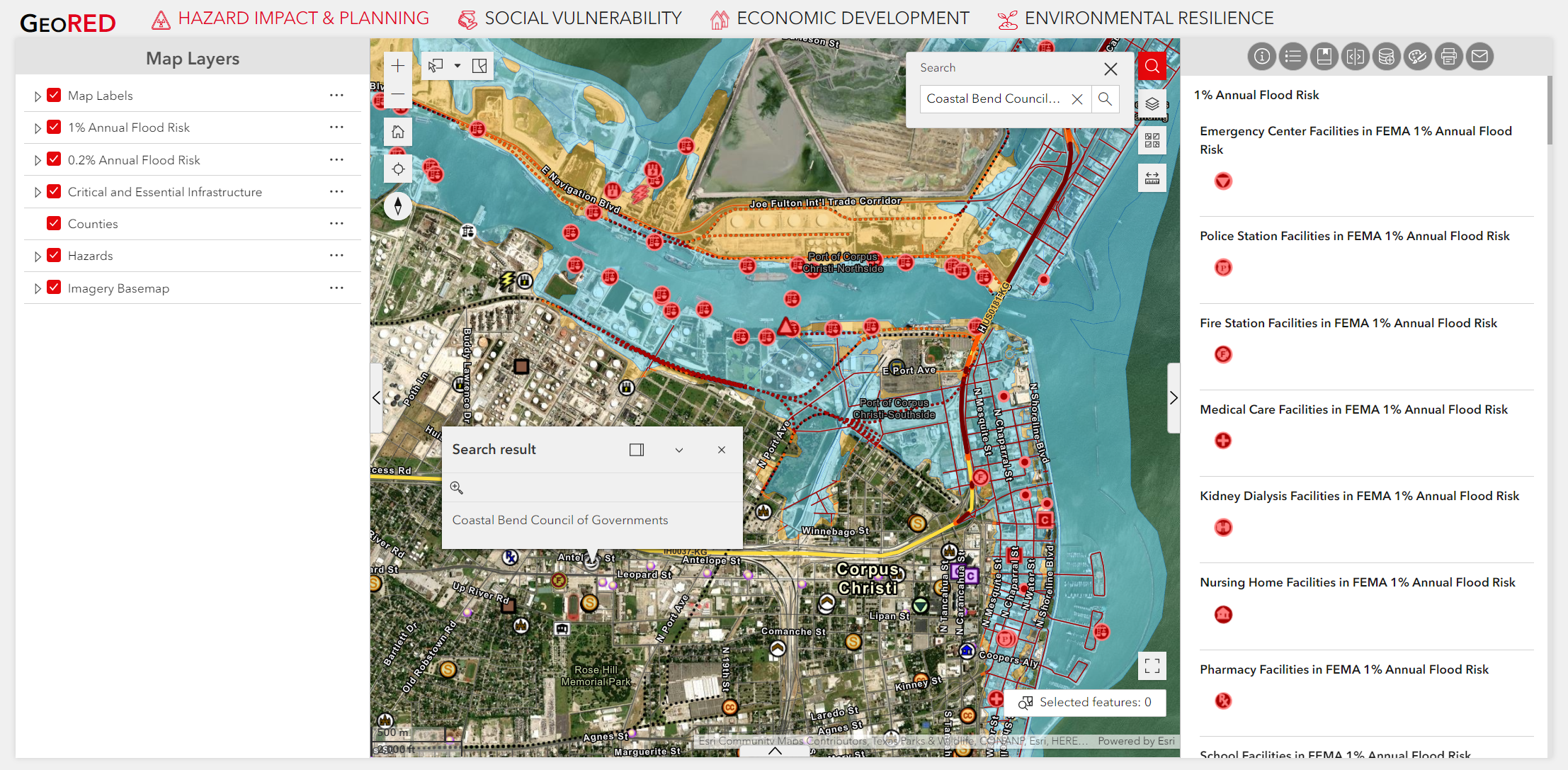
Hazard Impact and Planning Interactive Map
View "Access the GeoRED Interactive Tools" on the homepage
Select the Hazard Impact and Planning Tool
Search for a location
Use the search bar to enter a specific location, or use the “+/-“ buttons to zoom in and out
Establish your basemap
Using the “Basemap Gallery” tab, choose the style that best fits your needs, and the “Legend” tab to see specific data available in the area of interest. Note that using the +/- buttons will change the layers displayed on the map.
Choose your data
Use the “Legend” tab to turn layers on and off by clicking the checked/unchecked box next to each data layer.
Tailor your map
Use the ‘Add Data’ tool to add your data to the map, the ‘Measurement’ tool to measure area and distance, and the ‘Draw’ tool to add shapes, lines, or text.
Share your results
Use the ‘Print’ or ‘Share’ tools to print or embed the data in a website